
Day 14
Start: 151.9 End: 168.5 +2 miles on side trip for agua. Total= 18.6
After a nice beach vacation I was ready to get back on trail! Awoke around 6:30 and was on trail by 7:30. Nick walked out a few miles with me and it was steady trail with big rocks and pretty views. We said our goodbyes and it was much sadder this time as it will likely be a couple months before I see him again!

After he left, the trail steadily began rising in elevation. There were no water sources on trail but a few various lengths off trail. I was going to go to the bottom of one but the reviews didn’t look great. I decided to play it safe and go to the one “moderately sloped”, a mile off trail. Ugh. I really hate doing any miles that aren’t part of the trail.


I went and it felt steeper than moderate. I took everything out of my pack so I could make it a quicker and easier walk. The walk down wasn’t so bad and I entered a beautiful cedar grove, hence “cedar springs”. There were a lot of decaying trees and so there were billions of ants everywhere. I filled up a few liters and brought a couple more to filter later. That pack sure was heavy and there was only water in it.

It was a grueling return to the trail and I was soaked and grumpy. I made it back and another hiker I had passed earlier in the day made me feel dumb by saying he was just going to let snow melt. I didn’t want to count on that but in hindsight that’s exactly what I should’ve done.
I took another half hour to eat my lunch and recover from the side mission before pushing on and upward. The trail continued to rise and so did the temperatures. It was a super hot day and my pack was quite heavy with water.


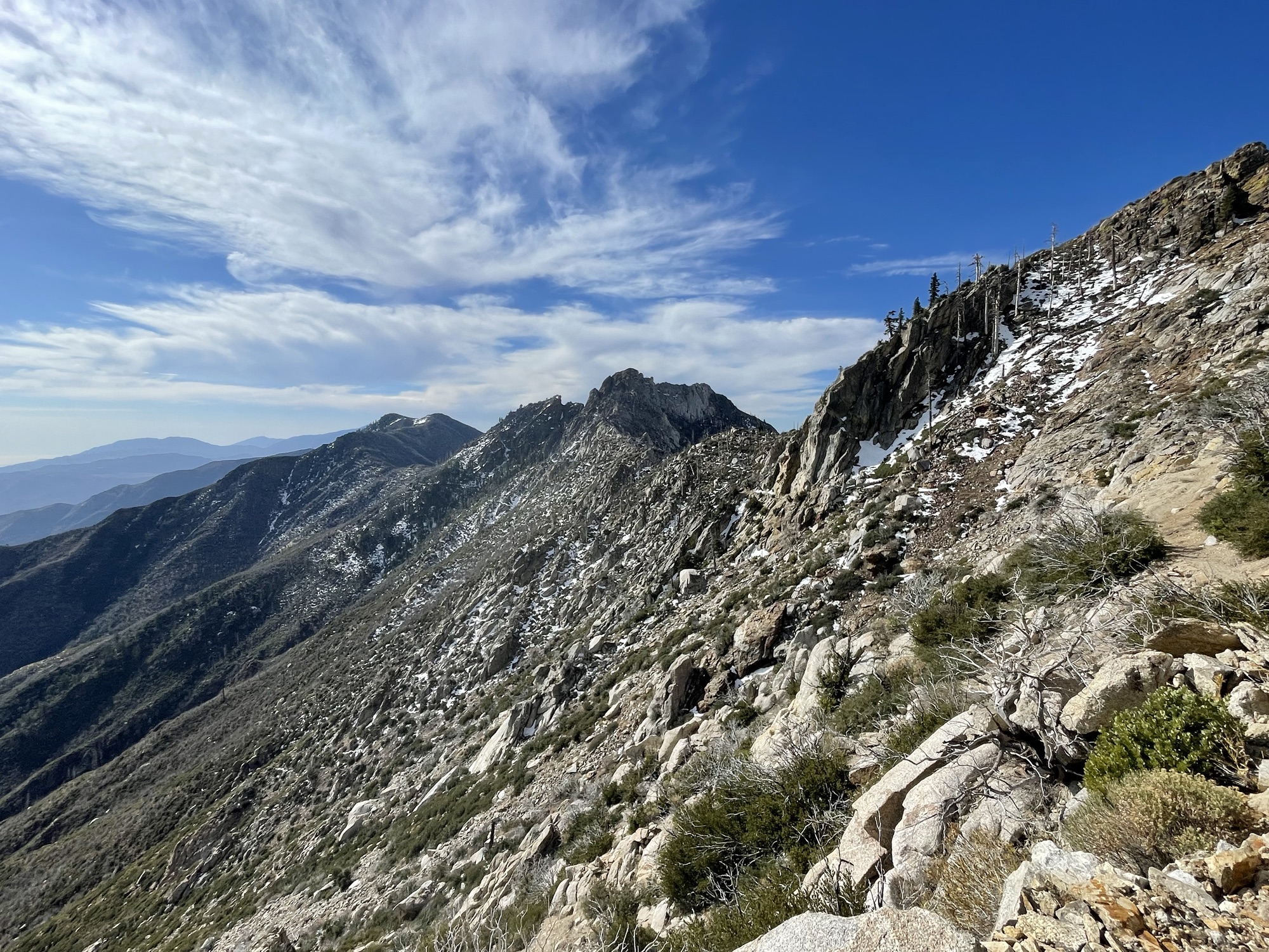
The trail came down a bit then straight back up. I guess there was a fire 6 years ago and a lot of trees fell over. So instead of rebuilding the trail they built a new one, right up the side of the mountain. When the pct was built they had a vision of it not surpassing a certain degree of slope. This vision went out the door when they redid this.


I was intending on pushing to the next campsite but after that grueling climb I decided to stop short. A man who called himself Old&Slow was there and a woman, Braveheart and her husband Juan.
Braveheart was on trail 3 months after having brain surgery. Someone had hit her mirror when they were pulling out and she got out to look at the damage when that person opened their car door, smacking her on the head. Rightfully pissed, she went to the hospital to get an MRI. The doctors found a ping pong ball sized tumor in her head. They were able to carefully and safely remove it and her plan to hike continues!
Old & Slow has done a lot of the PCT before but is just out here enjoying this section! He has an RV at the trail head that I began at that day and will walk North until he tires of the snow then he will head back to his RV!
I had a little hidden nook and watched a beautiful sunset. I was sleeping 2000 feet higher than I was at the beginning of the day!

Day 15
Start: 168.5 End: 181.3 Total: 12.8
I awoke just before sunrise and watched as it came over the horizon. Old&Slow sang a happy good morning song and I had my morning coffee and packed my things. My trekking poles had come loose and were not resisting my weight but collapsing under it. Luckily Juan had a multitool and I was able to easily fix it!

I set out for the day expecting another big day of elevation change. It was an absolutely epic day from the very beginning. I was amazed at how high up I was at that I kept going up, the views of both surrounding valleys were breathtaking. I passed the other hiker early on who had stayed with us and there were some sketchier sections along a part called fuller ridge. Most of the snow had melted but in some corners it was still deep but heavily packed down. It was a long way to the bottom of you messed up but they were short sections with really solid post holes, where people had been repeatedly stepped and was frozen over. I could see where those parts ended so for many of them I didn’t even bother putting on my microspikes or taking out my ice axe, I thought the really sketchy parts were coming later.


I had started the day with my rain pants over my shorts thinking it would be super snowy the whole time. I quickly over heated and had to take the rain pants off. This whole side of the mountain however had burned down, and in place of the big trees that once grew there were abundant thorn bushes. My legs were scraped to smithereens that day.


I took a break 2 hours in and had gone 3 miles, it was slow travel but absolutely stunning. There must’ve been 100 fallen trees, some you could easily step over, some you had to climb in top, some you could go around, some through.
I took another break 2 hours after that and had only made it another 3 miles. There was no good water sources but I got the beta yesterday about just putting the snow in half full water bottles and letting it slosh around and melt so I repeatedly stopped and filled my bottles with snow.

After my second break the trail winded around the top of a mountain and went along the north facing side, which rarely sees the sun. There was a couple feet of snow back there and it had started to turn sloshy. I pulled out my brand new ice axe once and held onto it for a bit until I decided it was more trouble then help. The sections I had done earlier in the day were way steeper and sketchier but I thought this was supposed to be the sketchy part. There were pretty solid tracks through this part so I was able to avoid postholing much myself but still did and still had the occasional slip and fall on butt.


The tracks were pretty easy to follow until one point where I got confused and followed one persons tracks who had also got confused. They eventually led me back to the trail though. I stopped for lunch on a sunny rock, just .5 mile before saddle junction. Saddle junction is another point where hikers can take a side trail and get into Idyllwild. I would be passing that up since I just had a little vacation.
I passed saddle junction and made my way up, 2 more miles to camp. 2 more miles to where I said I’d meet my trail gal pals, Rocky and Spark before summiting San Jacinto, a mountain just off the PCT.
I went back and forth between having my microspikes on and taking them off. There were some sections that were clear of snow and others that was just mushy snow so the traction wasn’t super helpful. About a mile up though the snow became much denser and covered the whole trail and everything in sight. It was a grueling mile but I eventually made it to camp.

Camp was covered in feet of snow but I packed down a small area and set up my tent. Drying out my feet and socks in the sun on some nearby rocks. Shortly Rocky and Spark who had been in Idyllwild joined me and set up their tents. We planned on waking up around 3 am and be on trail by 4 so we could catch the sunrise at the top!


Discover more from Trekking Home
Subscribe to get the latest posts sent to your email.